Wednesday 30 April 2008

Kayaking porn . . .


Be gentle with me, I am a symposium virgin.

This weekend that is going to change. I am making the trek from South to North Wales, to the Gogledd where "Gogs" do live. Passport is ready and have brushed up on my Gog speak. (I should explain there is a bit of the Irish, Cork and Kerryman banter between the North and South Walians.)

Can you tell I'm excited, well wouldn't you be. Anglesey, hub of Welsh sea kayaking and all that. Nigel Dennis is running the 24th Anglesey Sea Kayaking Symposium.

It promises to be a long weekend orgy of kaykaking stuff. I promise to share the kayaking porn when I return, if that is the overfalls don't swallow, but spit me back out!

Wednesday 23 April 2008

Friends Reunited

Until today, I haven't walked for three years. That long ago I had a fortunate motorcycle accident. This involved trying to pass myself and motorcycle under a crash barrier on a remote Spanish twisty mountain road, and fly without wings over the edge.

Not recommended, but it did have some useful outcomes. I thought at the time I was about to check out-the exact moment was-"I don't think my head is going to fit under that".

I walked away with an ankle broken in 3, and a rearranged perspective on life. I say fortunate accident, as it became a life reassessment moment, and in a roundabout way led me to return to surf kayaking and the discovery of sea kayaking. (And that really was the end of life as I knew it!)

The rather over dramatic introduction of not walking needs some clarification. I refer to mountain walking and the reuniting was with my boots. It was refreshing to get out for a proper walk with some old friends (of the human kind) after such a long time.


I like mountains, enough to have been an active member for over 10 years of a mountain rescue team. My stomping ground was in the Brecon Beacons, the wilder, remoter, west of it. Here I developed a mentality of carrying all the required kit for the "what if" situation. (And the additional kit do deal with the current "has happened" shout.

This mentality seems to have found a home nicely in sea kayaking. Day, Night, Sun, Rain, Wind, Fog, Snow, whatever. Being able to face and deal with the weather mother nature decided upon is very empowering, to the extent that her moods lacked respect (within the remit of our sub 1000m operating zone I should stress).

The sea on the other hand (or foot) has the greatest of my respect.

I hope it always stays that way.

Wednesday 16 April 2008

Walk or take the Escalator

After a few days of windy conditions it was a change to come home and find the wind had dropped off a little. Looked as if it would turn into one of those nice evenings.
I jumped at the chance to nip out for a short paddle along the coast.
The tide had just turned and was starting to ebb. Having no shuttle, it would be a there and back trip. Decided therefore to go out against the tide from Southerndown towards Nash.
I've paddled this stretch of water a few times now. It isn't getting boring, I guess just like a favorite local walk, it is convenient, less than 10 mins from home and along a beautiful stretch of the Glamorgan Heritage Coast.
Each time I've done it it is different. Today it felt like a jogging trip, a feel good trip to balance the weeks calorific intake against energy expended, so it felt good to be working hard against the gradually increasing opposing tide. After about an hour I could see the base of Nash Lighthouse and turned for home. Paddling back into the setting sun with the tide this time, it only took about 20 mins to return.

The sun's going down like a big bald head - Sharkey's Night - Laurie Anderson

I remember when I was little, (and confess, occasionally still do for the hell of it), running up escalators the wrong way to see if I could make it to the top.

Do you take the lift or the stairs?


It is fairly plain at which point I turned back, but I do worry how many kids these days can actually interpret graphs.

Saturday 12 April 2008

Stand and deliver!

This weekend for Mark Rainsley is the culmination of 18 months hard research, hard paddling, hard organising and no doubt some hard core fun. It is the launch date of his new book South West Sea Kayaking.


Devon bound, a group of kayakers first meet up at AS Watersports in Exeter, where the book is officially unveiled, before heading down to the Pigs Nose Inn for some home cooked victuals, cider, slide show and talk.

Everyone unashamedly (self included) seemed to quickly look through to see how many times their photos were in it and if they could match Heathers picture count. Not a chance!
The book is a great resource for anyone wanting to explore the varied south west pointy out bit of the UK. 50 trips with all the local knowledge you would want to plan a safe and interesting trip for each one, and some great pics (of me) of course!

Slapton Sands

Not able to stay down for a Sunday paddle I teamed up with Andy Levick for a short paddle in the afternoon. We paddled from Strete Gate on Slapton Sands (site of disasterous Operation Tiger) through a bit of a squall to the Dartmouth estuary, had a great Devonshire Cream Tea (what else) at the old castle café before heading back.

Just before the squall passed by


Andy enjoying the sunshine


The American amphibious tank, recovered from the bay, used as a memorial to the 749 lives lost during Operation Tiger 28 April 1944 in preparation to the D-day landings in Normandy.
Quick, sharp! to the pub!

By the time we arrived at the Pigs Nose we were eager for our tucker and many a cider was swiftly sunk, being enlightened by Marks entertainment.

Start Point lighthouse


:)

Thursday 3 April 2008

Mine Blowing

Half day off, surfing on a lovely sunny afternoon.


I was being waved at from the beach to come ashore. Looking around I could see it was not just me, but everyone was leaving the seashore. I began wondering if the sea was contaminated.


Not quite, we were being cleared by the local coastguard to allow a Navy Bomb Disposal team to blow up a WWII marine mine that had been discovered on the beach.


I'm not sure if it had floated there or had been uncovered, as I didn't go over and have a look. Apparently it was one of the kind with spikes like the picture above.


Chris managed to get a shot of the water blast as the thing blew up.


Over 60 years on, a stark reminder of the debris of war.

After the bang, we were allowed back onto the water, but by then the surf had died down.

Photos (except the mine) by Chris with his new camera.

Wednesday 26 March 2008

We're loosing it . . .

. . . an hour that is, one less in the morning, groan, but more light to go out on the sea after work, yipee!
This weekend sees the start of our daylight saving.
It gives my soul a boost and marks the start of sunny days to come . . . ?

Tuesday 18 March 2008

A second chance

Wreck of the Tanker BP Driver off Nash Point
I recently came across a pile of aerial photographs I bought as a job lot years ago, all taken around our locality. One that stuck out was the picture above, of a wrecked tanker. It was marked "Tanker at Nash - 1956".

Curious to find out what had happened, I eventually found information regarding wrecks in the Bristol Channel. There were none in '56. But I found a small amount of information regarding the BP Explorer.
"In Feb. 1961 she capsized and was lost with all hands while on passage from Swansea to Sharpness, she was discovered the next day by the old Severn Railway Bridge. The BP Explorer was salvaged and rebuilt as the BP Driver and in Jan 1962, in severe weather she too was wrecked on Nash Point, this time, thankfully, no lives were lost."

So this could be the BP Driver, there is no other mention of a tanker wreck off Nash Point that I can find. She didn't have much luck.

BP Driver off Nash Point
Click on the smaller picture above to see some detail, and you will see a lifeboat remaining on the deck. I assume that there was a second lifeboat used to save the crew. The open wooden boat isn't the sort of thing I'd like to be climbing into in a storm, but then again if your mothership is on the way down you make your choice.

Sunday 9 March 2008

Waiter! There's neoprene in my soup!


Not exactly a good day for surfing, but surfing was a good way to end the day.

Saturday 1 March 2008

Dydd Gŵyl Dewi (St Davids Day) and the Pirates of Penzance


March the first is St David's day in Wales, the day on which our patron saint died in 589AD.
One of the ways we celebrate him is to wear one of our national emblems. Traditionally a leek (being St David's own symbol) being worn by men, and the daffodil by women. The Welsh name for both plants are similar Cenin Bedr (Peter's leek - daffodil) and Cenin (leek).

Ready for school

Historically the Welsh and English have not been the best of mates, the invading Saxons in 633 met the Welsh at a battle in Heathfield. The fields here were filled with leeks, we put them in our hats to distinguish ourselves from the Saxons, and we won the battle.
I remember wearing a leek to school and we generally chomped our way through the raw veg all day. Maybe the smell of raw leek was enough to drive the Sasanachs away!
It was rather fitting therefore to arrive in Cornwall and be greeted by fields amass with commercial daffodils.

I digress. I am down in Penzance being a guinea pig for Richard Uren, a change from being a surfing hamster, (check these surfing rodents out). He is running a level 3 assessment and had put out a request for some student volunteers for his candidates to work on. Jim and I did not want to pass on the opportunity to get out on the water somewhere new, and perhaps we might learn something in the bargain.

St Michael's Mount

The first day we play around in general purpose boats in the safety of the harbour going over some personal skills. A visit later to the Dolphin pub for some ale and the search for smugglers passages.

The second day saw us on a short trip along the coast to Mousehole, via Newlyn Harbour.

Tidal Observatory on the south pier at Newlyn


You could pass the above building and not know it's significance. It is the site of Ordnance Datum the datum height for all our Ordnance Survey maps. I was looking for a shiny plaque, but there is nothing here, not even a description of the important work that was carried out here. A tide gauge was sited inside the observatory, where hourly readings of the sea level were recorded from 1 May 1915 to 30 April 1921.

At the foot of the old Penlee Lifeboat slipway. A tragic tale.


Penlee Severn Class Lifeboat, moored at Newlyn Harbour

Jim is generally not an Isolated Danger Buoy!


Jim looks for sunken treasure

We didn't get to see any pirates.

Friday 29 February 2008

Some like it rough


Looking at the colour of the water you'd be thinking that this is not close to home. You would be correct. Praa Sands in fact, Sydney Bay to be precise, near Penzance. No brown water down here.


A nice bit of wind and some white water (mixed with the blue) and I'm ready to get some tentative practice in boisterous water with the sea kayak.
Even manage to surf the old girl.


It handles like a bus with my driving skills.


I have a very enjoyable time none the less, and feel exceedingly battered after a good workout.
Thanks to Simon for taking the time out to show me the ropes, so to speak, the beach and for taking some pics.

Sunday 24 February 2008

Son and Surf


Had a great time taking Taliesin out for a short surf session. He took a while to thaw out though.


I borrowed a Mega Impulse and a Neutron to try out. Impulse did it for me (the bigger version). Resulting conclusion I now have to face, is that as from today, I must be a large paddler.
The rest of the day I had that afterglow feeling you get when your body finally returns to operating temperature.

Monday 18 February 2008

I am lusting


Let's be clear about this. It is the boat that takes my fancy. Made by Glyn Edwards out of cedar strips. It is dead gorgeous to look at and to feel it's curvaceous body is just the dogs blokcols.
It has 5 fin boxes so various combinations of fin set up can be used. Sadly it will have to remain an object of desire, as will some other extremely nice toys at the CanoeExpo held at Stonleigh this weekend. I thought it was a great venue, central, free car parking, a fantastic lecture program.
I hope Brookbank find a beneficial solution to involving other companies that they don't act as retailers for. Some of the stands stocks were restricted to Brookbank stock items, which was a bit annoying for me as all the stuff I wanted to buy wasn't there.
The talks, however, did it for me (as well as the ceder surf kayak). Inspirational and educational.
The show had a great buzz about it. A great opportunity to see and talk to many great people in the kayaking world.
I hope Brookbank come away thinking it was a success, as the last time I remember going to a show like this was over 25 years ago in Crystal Palace.
Hopefully next time the weather will be really bad. I felt guilty for losing a fantastic day for kayaking.

Sunday 10 February 2008

Local Knowledge . . .


Lesson 1: You can't get it all from charts, but it does help if you use the right charts.

This trip I did something different to my normal planning. I thought I'd plan the trip from a land map. (After all, most people I know use OS maps when they paddle). Besides, I hadn't laminated the chart and the GPS software was OS based. (So I guess I was just too lazy to plot my waypoints by hand).

The 48km trip from Penclawdd to Tenby was an ambitious trip, but with perfect timing for an early morning spring high tide, and equally perfect weather forecast, what could possibly go wrong. We would make easy meat of the Carmarthen Bay crossing. (Thinking back on it, Jim did mention something about a really big swell, but it didn’t really register).

8.20 am

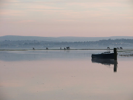
Penclawdd is, a tranquil place, on the Lougher estuary. Famous for its cockles and laverbread, harvested here from before Roman times.
None of that this beautiful morning, cockle beds were well and truly covered by seawater.

Any one for fresh cold cockles?
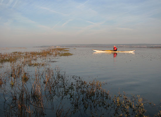


Jim sets off

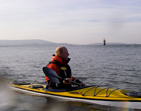
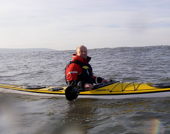
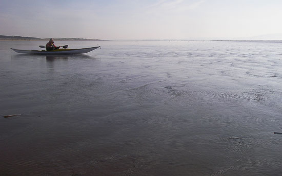
After a quick call to Swansea Coast Guard, we're on the water just as the tide turns.

Ripping along now at over 6 knots. Sun on our backs, perfect. As we approached Whiteford Lighthouse the ocean swell became noticeable.

Now you see the lighthouse.

Now you don’t.

Where did this surf come from. That wasn't in the plan.


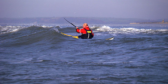
How did we get in front of the surf zone without really going through it? Strange.


I like using the spray deck I was using to day as it has a handy front mesh pocket to carry my day and night flare on my person, it is also easy to put on. I hadn’t anticipated any surf. It is not the spray deck of choice for going surfing, easy on – easy off.


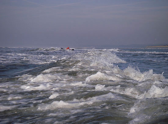
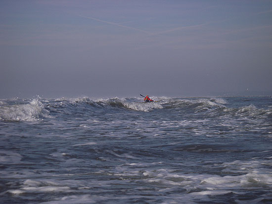
We headed out towards open water, the surf increasing as we progressed.

Two rather large waves, one from the left, other from right, joined together and seemed to rise to twice their individual heights and broke on me broadside. No problem, I can deal with this, just dig in and bongo slide. (Always works in the surf kayak, not so today). I was over. My thigh had dislodged itself from its grip, so I pulled my bum back in to the seat and orientated myself for my roll, waited for the aerated water to die.

Nearly made it! Nearly isn’t good enough good boy!

The surf dump had popped the spray deck – I’ve practiced rolling with a boat full of water, so that chestnut doesn’t wash. I can think of excuses, whatever, with lungs newly filled with air I sat upside down and decided to bale out. I had failed and was in the drink. Deal with it. It, was cold!
Jim came along side and I was very quickly back in my boat.

Lesson 2: Adapt to changing circumstances.

Feeling a little bit taken aback by events we decided to land and assess our situation.
Not knowing how deep the surf zone extended on this weird beach, or how many more of those big fellers we might encounter before breaking out, we decided on a change in plan.

Paddling just inside the break amongst waves we could comfortably handle, we would make progress along the coast (10 km) until we came to the Towy river mouth and break out there.
Ha, ha that was the plan. The strange "captivating" beach of Pembrey, however, had other ideas.

After a reviving hot drink of chocolate we got on our way. It was going to be slow hard work now and the effort soon had me warmed up. I was glad to be moving, standing around would have let the cold get a hold.

The effects of the second highest tidal range in the world is best seen on spring tides. Particularly on flat beaches. Both Pembrey and Pendine Sands are very flat. As a consequence the tide goes out at a walking pace. Jim floated his kayak in the water, jumped in, by the time his deck was on, the tide had receded a good 8 feet!

OK, who nicked the sea then?

This was to become a real pain. We were constantly being land locked, and often suddenly paddling in less than a foot of water. Quicker to jump out and push the kayak into deeper water or over the sand bank that had appeared from nowhere. Time is ticking by, we are not making the distance anticipated. No assistance from outgoing tidal stream and we are almost pushing our kayaks along the seabed with our paddle blades in places. A quick call to the coast guard to let them know we will not be making Tenby, but are aiming to complete at Pendine. (Ironically the location of many land speed records).

We are paddling (walking, dragging) inside a Ministry of Defense firing range. Notices, (we notice on our arrival at Pendine), warn of not touching any objects on the beach as they may be unexploded munitions. Someone is having a laugh.

It turned into a 21km trudge with some compensation being a days worth of broadside practice.
We arrived at Pendine feeling the need for a well earned rest.
At least I had finally tested in anger the suitability of my paddling gear. No dry suit, but a wicking layer system I had borrowed from my MR days. Wet suit boots for feet, fleece trousers under Palm Cobra pants for lower half, on top a long sleeve wicking shirt under a long sleeve thin fleece, under Palm Yukon cag.

As I paddled, the clothing began drained itself of the water, collecting at my feet and at the cuffs of my paddling top. To be emptied every time I got out to drag the kayak across the sand! The water ingress is mostly through the jacket neck which doesn't have a seal. The ankles and wrists have very effective seals. Most importantly, although wet, I wasn’t cold. However I wonder how effective this set up would be with a strong wind blowing and less mild temperatures.

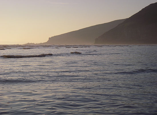
Tenby is just a little bit further around and across there!

Lesson 3: Admiralty charts are good at showing things under water. 
OS maps are good at showing things above the water.

Trip stats: Distance 21.2Nm (39km) Time: 7hrs 50min. Max speed: 6.6knots Av speed: 3.2knots